Minerals data collection and management
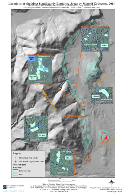
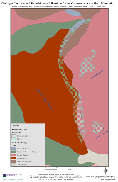
I was a GeoCorps participant on the White Mountain National Forest in NH, where I was tasked with upgrading the Forest’s data collection and management in the Minerals program. The Forest has designated hobby mineral collecting sites, as it is rich in mineral deposits of interest to the public (namely smokey quartz, amethyst, amazonite, sapphires, and many others). There was a lack of field collected and reference data on these locations, and limited documentation of illegal digging activity. I spent the summer performing fieldwork collecting data with a Trimble GPS unit, and digitzing historical paper maps that could be used digitally by staff. I also created an analysis using slope and proximity to streams/trails/probability of mineral deposits to create a simple likelihood map that aided in our fieldwork to find undocumented sites. I do not have that map any more, but we did find a handful of sites using this method (some documented in maps below). My findings were presented to Forest leadership so they could understand the increase in activity on the Forest.
 Larger version here
 Larger version here