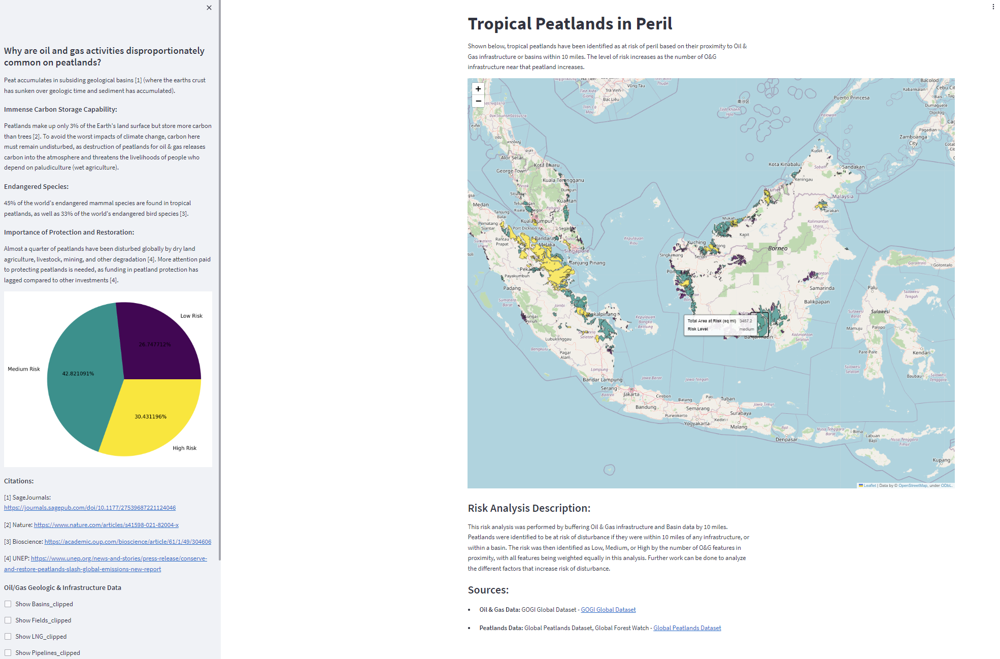
Identification of peatlands at risk from oil & gas extraction
I recently experimented with creating a streamlit dashboard with the results of a simple geospatial analysis. I used a global oil & gas infrastructure dataset to identify tropical peatlands at risk of damage from oil and gas activities in the region. Tropical peatlands are an import global carbon sink; peatlands have much greater capacity for this than other types of land.
For this application, I also experimented with hosting it on Huggingface, a popular platform for machine learning apps that can also be used for other types of applications such as mine.
View the app on Huggingface here
View the code repository here